OpenTopoMap
A topographic map from OpenStreetMap and SRTM data
Install / Use
/learn @der-stefan/OpenTopoMapREADME
OpenTopoMap
OpenTopoMap is a topographic map out of data from OpenStreetMap and SRTM. If you are interested in building your own OpenTopoMap, see the beginner's guides for a tile server and for Garmin files.
Mapnik
The main OpenTopoMap is a online rendered raster map. It can be used with the web interface on https://opentopomap.org, which gives you nice features like a search function or loading your gpx tracks. Futhermore, OpenTopoMap can be included into other applications. See https://opentopomap.org/about#verwendung for information on usage. The license of the online map is CC-BY-SA.
The online renderer is based on Mapnik. All necessary files are available to build your own OpenTopoMap server. Please note, that the old raster tiles are depreciated. OpenTopoMap will switch to vector tiles.
Tilemaker
New vector tiles will be generated via tilemaker and are based on a modified shortbread scheme.
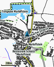
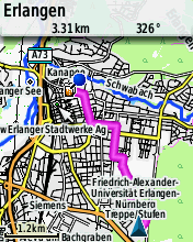
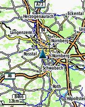
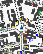
Garmin
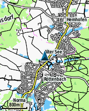
Since summer 2014 there is a Garmin edition of the OpenTopoMap. They can be downloaded from http://garmin.opentopomap.org. The license of the Garmin maps is CC-BY-NC-SA and therefore reselling is not allowed. Here are some screenshots:

Related Skills
node-connect
344.4kDiagnose OpenClaw node connection and pairing failures for Android, iOS, and macOS companion apps
frontend-design
99.2kCreate distinctive, production-grade frontend interfaces with high design quality. Use this skill when the user asks to build web components, pages, or applications. Generates creative, polished code that avoids generic AI aesthetics.
openai-whisper-api
344.4kTranscribe audio via OpenAI Audio Transcriptions API (Whisper).
qqbot-media
344.4kQQBot 富媒体收发能力。使用 <qqmedia> 标签,系统根据文件扩展名自动识别类型(图片/语音/视频/文件)。
